Tuesday, December 15, 2020

The Great West Trip Part 2

 Picking up where I left off we left the hotel Monday morning there was no breakfast because of Covid 19 but there was a coffee shop just down the block. Magnum coffee and roastery was brightly decorated with a giant Toucan on the outside of the building. Their coffee cups were beautiful works of art as well. I ordered the java potion which was a delicious mix of mocha, vanilla, and cinnamon sugar. The barista was very friendly and as we chatted she mentioned that she was going to be married in the next few months. We congratulated her and my Mom gave her some advice 

"It won't always be easy, just remember that."

As we approached California from Nevada we saw a bright light to our right, getting closer we saw it was part of a solar facility, the Ivanpah Solar Power Facility. It is a concentrated solar thermal plant and I had never seen anything like it with the mirrors reflecting the light to the towers. 


Next we took a detour to Bakersfield, CA because our check engine light had come on as we were driving through Nevada. We had gone far but not far enough that we should need an oil change and we were taking it to the closest Ford repair shop on our route, Jim Burke Ford to be exact. I drove to the back where the repair area was and Matthew came out to the car and checked our oil. It was fine, we suspected it was possible that since we had the last oil change done so early the internal counter hadn't reset. He showed me how to reset the system so that it would read that the oil was changed. While we were in town we decided to find the famous Bakersfield Arch and get lunch. The Arch was easy to find as we drove down Buck Owens Boulevard. We didn't actually walk the streets of Bakersfield but we walked from the car to Temblor Brewing and decided that was close enough to get the idea. The brewery was probably our favorite seating area of all the breweries we went to. It was hot and the long benches were enclosed in a covered patio and along the ceiling were misting hoses. At first I was a little skeptical but the mist was very refreshing and the dogs loved it. We had cooling vests for them that my Mom had purchased on chewy.com and those also seemed to help with the heat. 


The brewery is the work of three Bakersfield natives and their award winning head brewer. A relatively new brewery the idea began in 2015 and by September of 2016 they were open and serving customers. There are six mainstays and then a series of seasonal and rotating beers. The flights did a good job of showing the variety of their beers from the dark stouts to the varied colors of their fruit beers. 


Our next destination was Sequoia National Park and along the way we drove past a surprise roadside attraction in Delano, CA. The Halo company turned their packaging plant into a giant box of Halos, a happy accidental find.


It was already late afternoon when we reached the Sequoia National Forest and we started up (and down) the winding roads. We climbed up to the pull off to view Moro Rock and stopped to admire the view.   We continued up the road toward the Generals (Grant and Sherman) and soon found the largest trees I had ever seen. The Sequoias are completely awe inspiring towering above the road with trunks so wide you could lie in front of them and not cover the base. 


I took the photo of Meg taking photos and I think that is one of my favorite photos from the trip. 

Shortly before we reached the Generals we pulled over for a beautiful panoramic photo of the different peaks and valleys surrounding us. My Mom noticed a car with two couples who had been there before we pulled up and were still there when Meg finished taking photos. She said she thought they seemed stressed.  We asked if they were ok and learned that their brakes had stopped working on the winding road through the mountains they had managed to use a lower gear to get to the pull off but were unsure if they could go any further. A tow truck was coming but it had been awhile. Add to that being up on mountains no one had very good cell coverage. We gave them my number and told them we were continuing to the Generals but would come back and if the tow truck hadn't come we could at least get them down to the main ranger station where phone service would be better. After seeing the General Sherman, the largest by volume known single stem tree, we turned back. When we reached the viewing area they were no longer there. We hoped that meant that the tow truck had come for them and we had that confirmed when we reached the forrest entrance. The driver was putting their car down and we pulled over to check on them. Apparently the brakes had over heated and with a little bit of time they would be safe to drive, perhaps at that point they already were. Though they would want to get their brakes checked and change the fluid. 

Because we had started into the park so late it was already dark by the time we came back down. We stopped in at Three Rivers Brewing for a rest. The beer was good with the Oliver, actually made with olives, was interesting and the Honey wheat was my favorite. As we were sitting in the back yard one of the employees came out and we started talking. We told her we were just passing through and she told us about a few spots in the park that she considers the best for swimming and relaxing. While we weren't going to have time to explore the park I appreciate her telling us about the spots because they really weren't the regular tourist areas and it could be she tells everyone about them but it felt nice and personal that she was offering us her advice.

The next morning we turned north toward Lake Tahoe and some more beautiful scenery and a very unique statue- a bear and cubs made completely of pennies. My goal was to mix nature and roadside attractions and this was a perfect mix. The beautiful pines on the Sierra Nevada mountains surrounding Lake Tahoe framed the blue waters of the lake. The bear family made of pennies gave it depth and the pennies standing up looked almost like fur. 


This was the part of the trip where everything was a day away from the previous thing. So we did a lot of driving, saw a lot of beautiful scenery, reached our destination, and then went for dinner and looked for a hotel. In Lake Tahoe we stopped at 50/50 Brewing which Meg selected because they had a beer in honor of the Solar Eclipse- which was an amazing life changing event that if you missed it in 2017 you should really look up the path of the 2024 eclipse and make plans now to travel for it!!!

As we had been driving to Lake Tahoe we saw some signs of past fire damage on the pines but I don't think it was from current fires. However we did see a lot of haze and smoke in the sky. As we were starting to head further north back into Nevada the smoke grew thicker. We were trying to reach the Fly Geyser which I had first seen on the cover of a Time Magazine and was shocked to learn the fantastic image was some place in America. My understanding was that it could be seen from the road, we couldn't get up close because it is on private property,  however the smoke was so thick that we are pretty sure we saw something in its shape but could not see the vibrant colors that had grabbed my attention on the magazine cover. Then we began a bit of an adventure. We started driving north west to the California border. The smoke was getting thicker and as we drove animals would occasionally dart from the left of the road (west) to the right side (east) it was reminiscent of something from a movie when animals are trying to escape coming danger. And as we drove we soon saw the danger they were running from. In the distance there were two large red glowing spots and a few small spots. As we continued down the road more small glowing spots came in to view. Several times we thought we should turn and head back but our cell phones and GPS were having trouble getting signal and may not have been able to recalculate and also there was traffic coming from the other direction. However we eventually came to a road closed sign. We were looking at a long drive back the way we had come and while not low on gas we knew we had over 80 miles with no gas stations. It was almost 11pm when we returned to Gerlach, NV. Luckily the station pumps were still on and I was able to fill up.  I then drove over to the local bar to ask if anyone had alternate directions for us to continue on our way. There were a few people there and the bartender had the news playing behind him. One of the customers mentioned that a train had been stopped blocking one of the roads in to town but had since moved since the tracks were cleared of fire. That would allow us to return back towards Reno and from there we would be able to take a more western route to CA. I bought a few bottles of water for us and the dogs and we began driving for what would be a very long night. We ended up sleeping in the car that night and then driving and checking posters and asking other travelers at the rest stops to see what area was closed because the GPS was not adjusting for roads closed due to fire. 

We ended up getting back on track and stopping for breakfast in the small town of Alturas, CA. The city has been the seat of Modoc county California since 1874. Originally the town was called Dorrisville in honor of the bridge that Pressley and James Dorris built over the Pit River. The post office opened in 1871 and the name officially became Alturas in 1876. On its website the town declares itself "where the west still lives." And looking around that seemed like a good description. After sitting with our donuts and coffee from Wild Mustard we walked a few blocks to look at the murals, including a cowboy riding a bull and antelope grazing, around town and turned down one small street to see a pair of deer just walking down the street.

From there we continued on to our next location with giant trees: The Avenue of the Giants in Humboldt Redwoods State Park. 


The phrase "Go Big or Go Home" certainly applied on this trip. The picture on the left is a view inside a red wood which obviously gives the best idea of diameter. My Mom stopped at the base of one of the trees and I got down on the ground to get this angled shot up the trunk of the tree. Pictures don't do justice to give an idea as to how massive and impressive these trees are. Near the tree that Gypsy is sitting in was another tree dubbed "The Immortal Tree" this tree was somewhere around 1000 years old and had survived a lighting strike which had removed several of the upper limbs lowering its height from 298 feet to a mere 248, loggers, a forest fire in 1908, and a flood in 1964. This wasn't the first time we had seen reference to the flood of 1964, or the Christmas Flood as we also saw it called. Earlier as we drove among the redwoods we saw a sign naming the highway the "Sam Helwer Memorial Highway." It listed the many accomplishments of Sam Helwer who was the son of German-Russian Immigrants and was originally from Kansas. He began as an engineer for the California Highway Division when he was a little over 20 years old. Eventually he would become the Deputy State Highway Engineer and helped design the world's first four level highway interchange outside Los Angeles. Certainly his accomplishments had a great effect on the development of California but in Humboldt County he is remembered for his leadership as District engineer during Christmas week of 1964 where his action and compassion is credited with saving lives. 

After seeing the trees our attention turned to getting dinner and some place to sleep. We were all feeling a but tired after the adventure and not very restful sleep of the night before. We stopped at Eel River Brewing for some take out to bring back to our hotel, a Best Western right next door. I think this may have been the first time I stayed in a Best Western. The room was a suite which was great because it had two bedrooms which meant the dogs could get a nice break from each other... or really that Domino could get a break from Gypsy Rover. Gypsy never wants a break from anyone :-)

Eel River brewing is the first certified Organic brewery in the United States and is located in Fortuna, CA. As I have said before the craft beer industry is one of my favorites because so many owner/brewers are in it for the love of the product whether that be food or drink. They care about every aspect- taste and aesthetic. Eel River also has a history of sustainability. They use their spent grain to feed area cattle and have their own treatment system to lessen the burden on the environment. On their webpage they say they wanted to make a beer as hardworking and innovative as the locals of Humboldt County. The breweries motto is "Never straight. Always forward." which certainly has a good sound to it and I think says a lot. Obviously located along the Eel River, a major water shed in CA that phrase accurately describes the motion of the water. It also very well describes life and it definitely described our day of driving which had taken us in all directions as we navigated around northern CA. Good motto, good food, and great beer!


Our next stop was in Oregon but we still had a little more driving to do which was lengthened by construction- which we managed to hit in every state take my word for it infrastructure work is going strong! This time we had a long delay as we drove up a two lane highway that was closed at one point for about an hour as work trucks were hauling dirt from their location to a dump area. I knew going into these trips with the miles and distances we were going to be covering there would be random unavoidable delays so the best thing to do is make the best of it. Its not that different from sitting in rush hour traffic on the LIE or I-24: its there you are there and that is it. So we walked the dogs a little and cleaned the windows really well while we were pulled over. 

When I had been looking up roadside attractions along our path I saw a lot of "Paul Bunyan and Babe the Blue Ox" statues but had not actually worked one into my trip plans. But some times roadside attractions just happen and as we were driving Paul and Babe appeared on the side of the highway like the oversized figures they are said to be. So we stopped. Now normally with this kind of a statue we try and get Gypsy to do a sit stay and take her picture. But she was afraid of them so we didn't bring her very close. To give you some idea of size Paul is 49 feet tall and Babe is 35 feet tall. Honestly I knew of the stories of Paul Bunyan but always associated him with the middle of the country and Minnesota/Wisconsin and Canada. But given the existence of giant trees in CA it is no real surprise that the figure of American Folklore also found his way there. Although apparently there is some dispute whether Paul actually is a true figure of Folklore or if he was a creation to promote tourism. There are early accounts by loggers in the mid1800s about a Paul Bunyan who was a large man of 7 or 8 feet tall and 300 lbs. These stories give credence to him being a figure of Folklore as they all share similar details despite being told by loggers from Maine to Canada. But the stories of Paul Bunyan first reached wider audiences in the early 1900s when William Laughead published a pamphlet about Paul and advertising the Red River Lumber Company. In the pamphlet Paul grew to impossible heights as did his exploits including creating the Grand Canyon by dragging his axe behind him. In my opinion Paul and Babe certainly belongs to American Folklore. 


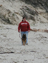
We then continued the trip up the coast. We stopped at one beach in CA right off the highway but a large sign said no dogs allowed so we didn't all get out. I did and I took some of the dark grey sand and sea shells and put them in a bag. I haven't it done it yet but my plan is to make a little display in a glass bowl. I had never seen the Pacific Ocean or coast before and this was one of the moments I was most excited for on this trip. From the sandy beach of CA we continued north to Brookings, Oregon and this time we did all get out at the pull off. Below us was a beautiful majestic rocky coast and the most beautiful shade of blue water. 


This is one of my all time favorite photos of Gypsy Rover! And the close up shot shows how beautiful and clear the water is. 

We continued from there to Yachats, Oregon and Thor's Well in the Cape Perpetua Scenic Area. Thor's Well is a rock formation that during high tide loos like a bottomless pit that the ocean flows in to. To get the full effect you need a high enough tide. While the tide wasn't as high as I hoped the Well was neat to watch as with each wave the water rose and fell inside it. We also got to sit relax and watch the sun set off the Oregon Coast. 

Yachats and Newport Oregon were beautiful small towns. The whole coast area was amazingly beautiful and that night was one of the many times when we decided we were getting a good taste of the area but needed to come back. 

The next morning we stopped for coffee at a Dutch Bros Coffee. On the lid of the cup it said "Make today an adventure" with all these trips I think we definitely fulfilled that statement. 

As we were driving we saw a sign for the "Enchanted Forest" which seemed familiar and it took a moment for us to realize that it was familiar because we had seen it on an episode of Ghost Adventures. The crew had done an investigation there because Aaron Goodwin grew up near the park and remembered going there as a child and hearing stories about it. Sitting in my dining room writing this blog post months after the original road trip it is a little bittersweet. Because I know that a lot of the area that we drove through, miles and miles of beautiful pines have been devastated by wild fires. I have heard stories on the news from locals about the loss of life and property that the people in that area have suffered. 

Our next state on the list was Washington and our destination was Mount St. Helens one of the volcanos in the Cascade Range. For the best view of the volcano we drove to the Johnston Ridge Observatory just four miles away from the volcano and with a stunning view at the crater caused by the May 18th 1980 eruption. 


From the Observatory we could see the damage done to the dome. We could also see lava trails flowing away from the volcano, a reminder of past eruptions. When we had been at an earlier pull off we had seen deer walking around at the base of the volcano.  At the Observatory I left behind a painted rock with a dragonfly on it since that is the official Washington state insect. 

Washington was the 25th state we had visited this year officially we were more than half way done with reaching our goal of all 48 contiguous states in one year. This trip was the big one. Not only was it a 2 week road trip but it brought us to states I had never even thought about visiting before. But here we were and there were still miles to go.


The next stop on the list was in Idaho and it is a bed and breakfast but sadly we were not going to be there at a time that would allow us to spend the night. Still though we went to see it because I couldn't pass up visiting a bed and breakfast in the shape of a dog! Not only that but they had a bed and breakfast in the shape of a tea kettle as well and several other fun designs. So if you are ever driving in Idaho near Cottonwood and you are looking for a place to rest. You could stay in possibly one of the most unique Bed and Breakfasts in the world.


We also got to drive along parts of the original Oregon Trail, a part of our history I love because of the computer game. We saw several historical markers noting the different routes like in Kuna Idaho and Bonneville Point. I think making this trip made me appreciate even more the pioneering spirit and bravery that early explorers had. We had GPS, cell service, regularly spaced out hotels, breweries, and restaurants. And I was still nervous about the trip. 

One of the reasons we went on the Great west Trip when we did was the long days. We needed long hours of sunlight to cram in as much sightseeing as possible. Right now I leave work at 5:30 or 6pm and it is dark out. Then I look back at this picture of a balancing rock in Buhl, Idaho that I took at 7:26pm! PM!! I repeat. And it was awesome out!


Also I love that tee shirt!  In college when I spent three months in Rome we needed to keep a journal for one of our classes. I brought my polaroid camera and lots of film so that I could take pictures on our different adventures and add them to my journal. It was a neat experience, much like I am doing now Meg and I had a map of Rome and every Tuesday and Thursday we had an art and architecture class that would bring us to a different area of the city. We would draw out the different paths we took on the map in an effort to see as much of the city as possible.

We stopped for the night in Buhl and had a fantastic meal and beers from Magic Valley Brewing. Decor was neat inside with a good rustic feel. We sat out back on the patio with the dogs. Despite my love for burgers, and the fact that we could smell burgers since they are grilled deliciously on the patio,  I ordered a MVBLT  and for the side I had to get their potato salad... actually I got potatoes every chance I had in Idaho almost like they are known for them or something :-)

The next morning we got up early to see  Shoshone Falls. Referred to as the Niagara Falls of the west it is 212 feet high and 925 feet wide. It was caused by flooding from Lake Bonneville and lies along the Snake river, which we spent a good deal of time driving along. We were there in August which is when the Falls are historically at their lowest flow amount partially because snow and ice melt from Colorado and Wyoming would have already finished and because the nearby power plant has a required amount to draw. Interestingly though it also has a required minimum amount that needs to flow on the Falls during tourist season of 300 cubic feet per second from April through Labor Day. Shoshone is the name of a Native American Indian tribe, also called Agaidika which translates to salmon eaters. The height of the falls made it impossible for fish to continue further inland and so the area surrounding the Falls was known to be filled with salmon and other fish. Apparently some reports said the river was so filled with fish that fisherman could through a spear into any area and catch a fish. I didn't know this but Sacagawea was a member of the Shoshone tribe.


Now it was Sunday August 30th and we had been on the move for over a week and my Mom had a request: she wanted a breakfast platter and she wanted to sit in a restaurant and eat it. And that is how we came to find the Buffalo Cafe in Twin Falls, Idaho. It was everything we wanted. The food was delicious with oversized proportions. I had an omelette and potatoes (because Idaho). The place was busy, for good reason, and the waitresses were on top of everything. Our food came out quickly and our coffee cups were always full. It was a spur of the moment stop but one of the best on the trip. I really liked Idaho the drive was beautiful and the people were awesome. I remember a few times when people saw the magnets on the car and asked us about what we were doing and really seemed interested in the trip. It was fun to get to share the drive with them while we were on it. 


Now next we were supposed to drive to our final stop of part two of the Great West Trip: Great Salt Lake. It was three hour drive from where we were and then Meghan asked "are we going to see the Salt Flats?" A coworker had mentioned it to us and of course Meg knew it from Independence Day, perhaps her favorite movie. I explained that it was an added 2.5 hours detour and that I was planning on skipping it. After all we knew we couldn't see everything in one trip there were lots of really cool things we were missing due to time and distance. As we were getting gas at a Sinclair Gas Station my Mom came over to me. She could tell Meg really wanted to go to the Salt Flats. I agreed and we changed the GPS to take us to the Salt Flats.

A little later on my Mom and I switched drivers so that I could grab a nap in the back. I woke up to my Mom commenting on how bright it was up ahead and Meg knew instantly: it was the Salt Flats. The Bonneville Salt Flats are the remnant of Lake Bonneville whose flooding 15,000 years ago resulted in the formation of Shoshone Falls. The brightness is from the sun reflecting off the salt flats which sometimes will have a layer of water on them that will give a mirror effect. We were there when it was dry and too late for any morning dew to have an effect but still it was incredibly bright. 

We then continued the drive to see Great Salt Lake  and Antelope Island where we got to see Antelope and Buffalo! We also got one of our favorite moments and a joke that is never going to get old. As we pulled up to the toll booth to enter Antelope Island we asked if the National Parks Pass my Mom had purchased was applicable to Antelope Island. The fellow said no but since we were in Utah today he would let us across anyway. Super awesome of him and his phrasing of "since we were in Utah today" gave us a laugh and became a bit of an inside joke for almost anything. 


We had reached the conclusion of part 2 of this trip and in my original plans this is where the trip would have ended. We would have gone home from Great Salt Lake having made a full circle on the Western part of the US. However when we had added the extra week and I expanded the trip to two weeks I decided to make a northward turn here that would bring us to Duluth and Lake Superior instead of making that a separate weekend trip.

Sunday, November 1, 2020

Drive the 48 Update!

 So I am very behind in blog posts but there is a lot that goes in to writing the blog and with work, planning trips and going on trips I haven't been able to complete the Great West Part 2 blog. However here is a quick update. This map shows every road trip we have been on this year highlighted in orange!


We have seen all the Great Lakes!

We have seen sunrise over the Atlantic Ocean and sunset over the Pacific Ocean!

We have travelled over 15 thousand miles and there are more to go!

Lifetime we have been to 47 out of all 50 states.

This year we have been to 44 of the contiguous 48.

There is one road trip left.... almost there.

Monday, September 7, 2020

The Great West Trip Part 1

When I started planning the Great West trip I broke it into three sections to make the planning more manageable. The first part would be our northern route to Utah so that we could approach the Hoover Dam from 70 and 15 which I was told by numerous people was an amazingly beautiful drive. And then of course arriving at the Hoover Dam. Part 2 of the trip would have us drive through CA and to the coast before turning south and east through Idaho to return to Utah and Great Salt Lake. Part three was a crazy turn north to Minnesota and Wisconsin before turning south to return home.  

First the prep: this took a long time. I looked at each state that we were visiting and began researching to find out what we should see. Every state has so many different sites whether they be historic locations, beautiful scenes of nature, fun roadside attractions, or marvels of human ingenuity. The task was to keep us on an efficient route and see as much as possible. It was a lot of looking at state's webpages, roadsideamerica.com, and Atlas Obscura to name a few. It also involved being open to talking to others and getting suggestions from them on where to visit or what route to take. For example my original plan had us taking the first leg on I-40 and traveling straight west to the Hoover Dam. But when three separate people told me about the 70-15 route I decided the added hours and miles were worth the view. Then looking at the map I tried to figure out what could we reasonably travel in a day while accounting for stopping for gas, walking the dogs, and stopping to eat. I also looked up some hotels just to have an idea of where we could stop but I didn't make any reservations so that we weren't forced to get to certain points. This way if we did fall behind missing a hotel check in wouldn't be an added stress. I also picked some of the cities we would be traveling to in order to monitor weather. Not that it mattered much. If the weather was bad we were still going but at least I would know what to expect... and what we expected was a very dry drive and a huge swing in temperature with a high of over 100 and a low in the 50s.

For some fun prep I also painted rocks to leave at various stops some were for specific states and stops and others were just generic rocks. 


We left Thursday right after work to get a head start for the trip and took a ride through some repeat states: Kentucky, Illinois, and Missouri. As we drove through Illinois the roadways were lined with beautiful flowers and we took note. At a rest area I noticed a sign explaining about the "Corridors for Tomorrow" project. In an effort to replace some of the lost prairie and wildflower lands the Department of Transportation is planting the highway right of ways with natural prairie grasses and wildflowers. We drove till roughly 1 in the morning and then stopped at a rest area for the night. 

On Friday morning we started off early and drove for a couple of hours before stopping in Odessa, Missouri which was platted in the late 1870s and named after Odessa Ukraine.  There we stopped at Black Box Coffee for breakfast. I had to place the order online for pickup since they were closed inside due to Covid 19 restrictions. That was a shame because inside looked very welcoming with a high coffered ceiling and large arm chair with a bookcase in the very far corner. As I waited outside for the coffee a speaker played music from the light post and a sign out font of a different business read "Thankful Friday Thank you Odessa." I ordered the Lavender white chocolate which was very tasty. I really could taste the lavender and the white chocolate complemented it without making the drink too sweet. 

Once we got back on the road it wasn't long before we crossed in to our first new state of the trip: state #18 on the year Kansas. We also made our first unplanned stop in Topeka when we passed the Monroe School which was involved in the court case Brown Versus The Board of Education: the case that would eventually result in a unanimous decision by the Supreme Court in 1954 that school segregation was unconstitutional and break from the precedent of Plessy Versus Ferguson that resulted in a "separate but equal" theory. Oliver Brown was the main plaintiff but in reality the case involved 13 parents and 20 children. The case was first heard in the Topeka court system in 1951 when the Brown's daughter, Linda, was denied enrollment in the closer white school and instead was sent by bus to the Monroe school. While the case was denied in the regular courts the Supreme Court opted to hear the appeal (along with four other similar cases) and on May 17, 1954 ruled that: 
"We conclude that in the field of public education the doctrine of 'separate but equal' has no place. Separate educational facilities are inherently unequal. Therefore, we hold that the plaintiffs and others similarly situated for whom the actions have been brought are, by reason of the segregation complained of, deprived of the equal protection of the laws guaranteed by the Fourteenth Amendment."


The Monroe school now serves as a community center and in 1991 was added to the National Historic Landmark Registry as a site of national significance.

Next we detoured to Junction City, Kansas named so because of its location at the confluence of two rivers, the Smokey Hill and Republican Rivers, which join to form the Kansas River. There we found a memorial to the 9th and 10th calvary units stationed at Fort Riley, The Buffalo Soldiers. These soldiers served in multiple wars, protected and escorted wagon trains, safeguarded railroad crews, as peace keepers, and as park rangers from the end of the Civil War until the integration of the military in the 1950s. During that time over 20 soldiers were awarded the Medal of Honor for their service to the nation. 

Next we reached our first planned destination of Abilene, Kansas. Abilene began like many western towns as a stage coach stop. In 1867 the Kansas Pacific Railway came through Abilene. That same year a large hotel and stock yard was built in the area which made Abilene a center of the cattle trade. 
On September 5, 1867 the first stock cars filled with cows left for market in Chicago. It is estimated that between 1867 and 1871 almost a half million cows were herded to Abilene by cowboys and shipped off.  The history of this town made perfect sense for why we would find the world's largest spur there.


With two dogs most of our activities and planned stops were things I could count on being dog friendly, so outside. I didn't look at any museums as a result while the Eisenhower Presidential library is located in Abilene we didn't detour to see it. 

Less than an hour later we found ourselves in Salina, Kansas. The town got its start in 1858 and served as a stopping point for prospectors heading west to Pike's Peak and emigrants on their journey west.  In 1867 the town changed when the Kansas Pacific also added a stop there turning Salina into a cattle town which lasted for two years. The next major industry was wheat and flour. In 1889 Lee Denim Company opened up its original factory there. 

We were there to see a memorial in honor of Steve Fossett's non stop flight covering 22,936 miles in 67 hours. The flight began February 28, 2005 and ended on March 3, 2005 beginning and ending at Salina Regional Airport. Steve Fossett was a businessman and adventurer who set numerous travel and speed records in balloon, ship, and aircraft. Growing up he was a Boy Scout and his time as a scout set the tone for his life not only of adventure and leadership but as a focus on inspiring others. With the flight from Kansas he insisted on having local students aid his flight team. His numerous records and dedication to fostering an interest in flight is what earned him multiple awards including: Induction into the Aviation Hall of Fame, a Gold Medal from the FAI, Induction into the Balloon and Airship Hall of Fame, and in 2002 was named Yachtsman of the Year by the American Sailing Association. 

Sadly Steve Fossett was killed in September of 2007 when the plane he was piloting crashed after being effected by strong downdrafts. I left a painted rock at the base of the monument, it was a helicopter in honor of the work of Rex Maneval who built an early helicopter in 1939.


We stayed in Salina to get lunch at the Blue Skye Brewery and Eats. The brewery had a nice but small outdoor patio area. It worked for us as the dogs got a break out of the car with enough shade to keep cool. The inside of the restaurant/brewery was nice with the wood burning stove serving as an attention grabbing center piece. We built a flight of most of their beers and ordered their signature pizza: cream cheese, house made pork chili verde, tomatoes, black bean and corn mix, house blend cheese, and red pepper flakes.  The crust was made out of spent grains and they gave us honey to sip the crust in which was unique. I will admit I was skeptical at first but gave it a try and it was delicious. 


An hour drive later and we were in Wilson, Kansas the Czech capital of Kansas. The town was established in 1871 along the Kansas Pacific Railway Line which we were following as we drove across Kansas. In 1874 Francis Swehla became the area's first Czech settler and he worked to attract other Czechs to follow his lead. They did. In 2003 local artists with funding from the Czech Embassy built and decorated a giant Czech Egg or kraslice. In July the town of 800 hosts an after harvest party celebrating their Czech culture that attracts over 1000 visitors. 


Next was another unplanned stop in Victoria, Kansas when we passed a sign for the Cathedral of the Plains: The Basilica of St. Fidelis. The Church was first called Cathedral of the Pines by William Jennings Bryan, although it is not a Cathedral. It is however the fourth Catholic Church in Victoria, Kansas. The first church was built in 1876 connected to a house of one of the parishioners, the second Church built in 1877 was the Mother of Sorrows, in 1884 it was replaced by St. Fidelis Church which could sit 600, and in 1912 that was replaced by the Basilica which could seat over 1000 parishioners. In 1971 the Church was added to the National Historic Registry for its architecture. In 2008 the Kansas governor Kathleen Sebelius declared the building one of the 8 wonders of Kansas, a list I didn't know existed but will now have to visit the other seven. And in 2014 the church became the 78th American Basilica and first in Kansas. 


We continued crossing the Central Plains on I-70 which earlier this year celebrated its 50th anniversary of completion in Kansas until we reached Colorado.


It was almost 10 pm when we reached the Laquinta in Limon, CO where we planned to spend the night. Despite our extra stops we were on track. I left Meg and my Mom with the dogs at the hotel and drove a block away to Oscar's Bar and Grill to get us something to eat. It had been a really long day and we were all feeling pretty spent.

Day 2 started with us finishing the drive to Longmount, CO. While campaigning Theodore Roosevelt took to the rails on what was called the "Whistle Stop  Tour." On September 25, 1900 Roosevelt stopped at the rail yards in Longmount. 


This was the first sculpture in a series that we found that someone had placed a mask on to cover the mouth and noise. A bit of an amusing joke the first time but it started getting old. I slipped the mask off to get a picture of the art work before returning it for a fun picture with Gypsy Rover. I also left behind a painted rock with a train on it in honor of Teddy's love for trains and their early role in shaping the country.

We walked around the downtown area filled with shops and restaurants to La Vita Bella for some coffee and breakfast. There I had a bagel with their very own home made vegetable cream cheese. We also stopped to check out another shop Winchell's Donuts. Inside Winchell's they had a number of signs showcasing their love of donuts and a history of the company which started in 1948 in California as a walk up donut shop. The company expanded in California and then in 1961 ventured out to Colorado and Arizona. In 1964 the geniuses created the first apple fritter in donut history (so the sign says) and I thank them for it!
 
Next stop was a strange one to find in the middle of the Rockies because it was a building built to resemble a Coney Island Hot dog which as soon as I read about it I knew my Brooklyn born Mom needed to go there. Next door to it was a gift shop that had several different local artists products and the artist took turns manning the shop. We have a similar store like that in the Opryland Mall. It helps to get artists a shared store front and exposure to lots of travelers. 

We were on a small highway driving up and down the Rockies. They were stunningly beautiful. At one point in Lake George we pulled over at an overlook. There was a historical marker that I went to look at. It named the road as the Ralph Carr Memorial Highway. Carr was governor of Colorado from 1939-1943. After the attack on Pearl Harbor when Japanese Americans were being held in internment camps Governor Carr apparently was outspoken against the camps. The monument quoted him as saying:

"When it is suggested that American citizens be thrown into concentration camps, where they lose all their privileges of citizenship under the Constitution, then the principles of that great document are violated and lost."

The monument was dedicated in 2010  through donations from the Colorado Asian Pacific American Bar Foundation. It also quoted a Japanese American Lawyer who had fought for his Civil Liberties and the rights of others about Carr saying 

"one voice, a small voice but a strong voice, like the voice of a sandpiper over the roar of the surf."

We then drove through the small town of Fairplay Colorado where their old courthouse and jail still stand along the main street where they have story boards telling the history of the town. The town was founded in 1859 during the rush to Pike's Peak. The town's name was in reaction to the large amount of land given to early prospectors and a promise that it would be split up more fairly to newcomers. We also passed through Alma, CO the highest incorporated town sitting at 10,578 it owns the record of highest post office in any country. 

We continued into Breckenridge, Colorado where we saw some beautiful scenery and stopped at the Broken Compass Brewery. 


Broken Compass is a small brewery that doesn't mass produce which means if you don't get it locally you aren't trying it at all. Which is one of the coolest things about the way we travelled ate and drank our way across the country. We definitely got to experience as much as possible. This was also one of the locations where we got to interact with people. A couple, visiting from Iowa, sitting at a table near us started up a conversation about our puppy, Gypsy Rover, from there the conversation morphed and changed into a conversation about craft beer and road tripping. In a cool brewery exchange they told me about one of their favorite breweries in California so I told them about one of my favorite breweries in North Carolina and with any luck we will all be able to eventually visit those breweries!

Next we were on our way to Glenwood Springs however part of I-70 was closed due to the Grizzly Creek Fire that was burning near the highway. As a result we had a long detour onto highway 9 and 131. While it added almost three hours to the drive time it took us through some beautiful landscapes.


The pictures don't do justice to the differences in color of the rock and stone and the lines caused by weather and time on the mountains. As we drove the canyon was filled with a cloud of smoke from the fire. Meg had brought her camera to try and take some star trail photos but it didn't look likely with the haze caused by the fire. 

It was almost 10 pm when we rolled in to Glenwood Springs having been able to rejoin highway 70 a little further west and taken the road east to get back to Glenwood Springs. There we stopped by what was once the Glenwood Hotel where famed Gunslinger Doc Holliday died on November 8, 1887. I had a painted rock with a spade on it and the words "I'm your Huckleberry". I left it on the window sill of a Doc Holliday themed store. It was Val Kilmer's amazing performance in Tombstone that made me want to stop here. In my opinion that is one of the best movies ever made and Val Kilmer's performance steals every scene he is in.

The next morning as we drove further west on I-70 we reached the peach capital of Colorado, Palisade and some more breathtaking views. 


And then Colorado became Utah as we drove along the Colorado Plateau. We stopped at a welcome center in Moab, Utah to take in the view. There a man was cleaning and picking up trash. He told us about a hawk that he had seen and some tricks to spotting the antelope that roam the area. 

The Arches National Park was too much of a detour from our path so we know we will have to return some day. We just had to settle for the rock formations that we passed. 


Throughout the trip we relied on my Mom's freshman year Earth Science course for basically all of our geography questions. And I have to say her knowledge held up very well. 

As we drove we scanned the radio for country music stations to listen to the Top 40 countdown and we found The Eagle 101.5 and Fitz. During the countdown he told the story of Jack and Sheila who met on their way to college with some other friends. Before heading out towards the west coast one of them referenced the Jo Dee Messina song "Heads Carolina, Tails California." Years later at a party Sheila saw Jack at a party and referenced the song again. And they have been together ever since. It was a good story and because we were driving we got to hear it twice since miles later when we lost the first station we picked the count down up again just before that story. 

Now I had been told this was a beautiful drive and it was true. We approached the San Rafael Reef from the east and as we approached it was amazingly striking. It is 75 miles wide made of Navajo and Wingate sandstone featuring fins, canyons, and domes. It was in 1957 when the decision was made to extend I-70 through the reef. The canyon we drove through was originally so narrow that early workers could stand and touch both sides. Workers removed 3.5 million cubic yards of rock to create the 8 mile stretch we were about to drive through the reef. 


Once on the other side of the reef we stopped again to look back at the western side and Devil's Canyon where we got Domino, my Mom's dog to pose for a great photo. 


As we continued along I-70 we saw more and more rock formations and the fantastic site of the painted rocks in multiple shades of red, orange, gray, and some that were even taking on a green hue. 


The different colors are created by oxygen levels and mineral make up of the sandstone as the area changed and developed throughout time. At one of the pull offs I left behind a rock I had painted to look like a post card on it was a quote from the American poet Wallace Stevens:

"The most beautiful thing in the world is, of course, the world itself." -Wallace Stevens

It seemed a fitting spot. Also at the area was a memorial to Linda Louise Terry Barnes who had served as a custodian to the I-70 rest areas for over 25 years and had sadly passed away in 2010 from cancer. The plaque honoring her was a nice tribute to her with a picture and a brief description of her personality and dedication:

"Her work was more than just a job. The area, the constant change of scenery, and meeting many travelers along the way were part of her... Linda was a beautiful woman who had many hobbies, including rock hunting and fishing. She was dedicated to her family and always wore a smile."

The words on the memorial made me think back to the gentleman we had meet at the welcome center in Moab who was also quick to pick up a conversation and welcome us to the area while he worked to prepare it for the day's visitors. 

A bit down the road we stopped for gas and discovered some tanks painted to look like giant soda cans. Looking back at this picture it is kind of ironic because my Mom spent the better part of this entire two week trip asking for Coke only to have wait staff respond "Will Pepsi be ok?"


We also stopped for lunch at Mom's Cafe in Salina, Utah where we ordered salads and burgers to go and ate them at a road side table. Two hours later and finally heading south on I-15 we saw a sign for the Parowan Cafe which claimed to have the best cinnamon rolls in the west. The billboard did its job and we pulled over for dessert. I bought one cinnamon roll and we split it. It was very good with a thick cream cheese frosting and raisins. 

We were approaching the end of our time in Utah, though we would be returning later in the trip to see Great Salt Lake. As we were driving we had noticed that it looked like there were bee hives on the highway signs. Apparently the beehive is a state symbol connected to to the hard working reputation of bees. Some how I missed that on my early research or I probably would have attempted to draw a beehive on one of my rocks. 

Our next stop was a statue of wild horses in a traffic circle. I had seen a picture of part of the sculpture and was very much looking forward to seeing the full sculpture. This was one of those stops that I hadn't mentioned much about because I wanted my Mom to be surprised when she saw it, I knew she was going to love it.


A short drive later took us to another spot I had been anxious to see: Ancestral Puebloan or Navejo petroglyphs, rock carvings with tribal and cultural significance to the ancient culture who made them. They could be markings of religious or cultural importance or they could be indicating important events and travels. Unfortunately there was no informative plaque at the park which is really an open area in a subdivision to explain what tribe made the markings or the history of the rocks which I assume were moved here. 


Next we entered Nevada and Arizona to see the Hoover Dam. It was built between 1931 and 1936. Before being renamed for Herbert Hoover it was named the Boulder Dam. The Dam would help to control the Colorado River, prevent flooding, provide irrigation, and provide hydroelectric power. Unfortunately the dam was closed for visitors due to Covid 19 restrictions- I understand they want to prevent large crowds and gatherings but there is definitely a way that the dam could be safely viewed. We tried to drive the highway to view it from there but a large concrete barrier made the dam impossible to see. While I knew the visitor area would be closed I thought there must be a way to view it. I stopped the car in the shoulder and walked along to try and see over the barrier and kind of got an ok look at the marvel of engineering that is the Hoover Dam.


The reservoir of Lake Mead sits high above the dam and a beautiful sunset was well on its way above me. We left the dam to get dinner at Boulder Dam Brewing. I had looked the location up before leaving and already knew that it was dog friendly and the food looked really good. As we ate we listened to the Vegas Knights playing the Canucks. The Knights won that game 5-0 and went on to advance to the next round where they are facing the Dallas Stars.

We went to our hotel for the night and ended part one of the trip. We were a little behind because of the added stops and the fire detour. But there was extra time built in to the trip and we were definitely still on pace. It was Sunday night. We were further west then we had ever been before and had travelled through nine states in less than 80 hours.