And here is where the Great West became a trip to the North! See the goal was to get to all 48 contiguous states and as you might be able to tell from the rambling route while we obviously had time constraints from vacation time from work we weren't looking to do it as quickly as possible (as far as I can tell the record is 96 hours and hats off to those guys) or in as few miles. No we were looking to see, experience, and taste as much as we could in each state. We also had other side goals like see both coasts and a sunset on the pacific and sunrise on the Atlantic and seeing all the Great Lakes. So instead of cramming Duluth and Lake Superior into a weekend trip I tagged them on to this trip.
So we left Salt Lake City, Utah and began driving North-East to Wyoming. I had a later road trip planned to go to Montana so I snagged a few things from that road trip and moved them up as a way to break up the long drive. On our way to our first planned stop we came across the nine foot cowboy in Point of Rocks, Wyoming. The area was once a home to a Stage Coach Line that saw passengers come through on their journey west and others heading to the gold rush. Today it is home to the nine foot cowboy. I don't know who built him or when but he gave us a laugh and we definitely snagged a picture.

A few hours later we were at our first stop: Rawlins, Wyoming to see a mural honoring the town's role in helping Edison invent the lightbulb. See on July 29, 1878 there was a total solar eclipse visible across a track of the US from Montana, through the Rockies, and to Texas. Newspapers report that a large migration of people traveled to see the spectacle that occurred at sunrise. In case you don't know a total solar eclipse happens when the moon passes between the sun and the earth at the right positioning for the moon's apparent diameter to block the sun entirely. If you would be interested in some more info about a Total Solar Eclipse click here for a blog post I wrote about the August 21, 2017 TSE. And click here for the post about the actual day. If you missed that Solar Eclipse there will be another Total Solar Eclipse that will cross America in 2024. If you are outside the USA ( I assume most people seeing this blog are in the USA) or a more adventurous traveler here is a list of upcoming Total and Annular eclipse from the wonderful website timeanddate.com Also I can not stress this enough but if you can get yourself into the 'Path of Totality' for a Total Solar Eclipse do it. Trust me you will remember it for the rest of your life. Seriously if you are at all interested take a moment and check out those other two blog posts. I've already started planning for the 2023 Annular and 2024 Total Eclipse it is worth the travel.

Now where was I.. oh yes Edison. Thomas Edison like many others travelled into the Path of Totality and settled on Rawlins, Wyoming to try and measure the sun's corona with his microtasimeter, he was able to measure temperature change in the corona with it. And then he went fishing. At the time Edison was looking for something to use as a filament in his lightbulb. His bamboo fishing pole in Rawlins is credited with giving him the inspiration he needed to use bamboo as the filament.

As we were driving to the mural we passed St. Joseph's Catholic Church so we decided to stop there, look around, and say a prayer. I also left a painted rock at the side of the Church. It was one of my favorites with a brightly colored sun set scene reflecting in water.


We had lunch and walked around Rawlins a little bit just to stretch and have some time outside of the car. There are actually a bunch of other murals in town though some have fallen into disrepair. They highlight the history and nature of Wyoming. We didn't find all of them as we had to get back on the road.


The next day we drove to South Dakota's Capital city, Pierre. Where we saw a quartz column that is a remnant of the original boundary set between North and South Dakota. It was known as the Quartzite Border because of the columns that land surveyor Charles H Bates used from 1891-1892 as he set markers every half mile (720 pillars) between the states. Also at the cultural center was a statue called the Citadel honoring the the pioneer women of South Dakota.


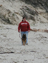
It didn't come out very well in video but the place was crawling or hopping with grasshoppers and Gypsy Rover and Domino didn't know what to do with them. As we walked the dogs the grass would come alive with the little insects. Domino wanted to catch and eat them and Gypsy was just trying to sniff at them and follow them around.


A few hours later we reached our first stop in Little Falls, MN the "Traveler." It is a rock statue on the property of Little Falls Granite Works. They create monuments and markers and have been in business since 1898. On the granite pedestal where Traveler stands it says:
"Life is a journey: stories shared about people, places and events that have shaped our lives.
The story of Traveler is a lesson about the human spirit and how we all need others to improve our lives. Traveler is derived from the Nomadic people- the Inuit- who built signposts out of stone in the shape of a human to help people find their way in the harsh and desolate Arctic. Each stone represented an individual who then became interconnected, each independently significant, together and stronger as a whole. The origin for the Traveler was called Inuksuk, pronounced in-ook-shook.
Traveler experiences life uniquely through the individual journey and is influenced by significant people, events and places along the way. Traveler is meant to represent you and your story."
The pedestal continues with the story of Charles Lindberg who was born in Little Falls and encourages others to take a photo with the statue and share their own stories of inspiration on the Facebook page.


And then on Wednesday we reached Duluth MN where I planned to spend the entire day because I left plenty of time to see the engineering wonder of the aerial lift bridge. There are these gigantic sky scraper sized boats that sail on Lake Superior... I'm talking boats that are well over 500 feet long and 40 feet high. However our stop in Duluth did not start out as planned because shortly before reaching the harbor the tire pressure light came on in the car. Now because we know our luck well we had both fix-a-flat and a plug in inflator with us. So we parked at the harbor and I checked the tires. All four needed a little air which was a good sign that nothing was really wrong. Had one tire been a lot lower than the others I would have been concerned. As I was filling up the front driver side a gentleman and his family stopped. He asked if we were ok and I told him yes and I appreciated him checking. The bridge's history begins in 1892 when John Low Wadell won a contest by designing a vertical lift bridge to span the canal between Minnesota and Wisconsin. His design was not built here but was later used in Chicago. In its place a transporter bridge was built with a gondola to ferry people across and still allow the barges to travel through the canal. However as demand for cars and traffic began to build up the gondola could not keep up. So in 1929 the bridge was remodelled and followed closely to the original design by Wadell. On March 29, 1930 the bridge as we know it today lifted to allow its first boat.


We arrived just in time to see the bridge raised for the BBC Thames, which was carrying wind turbine blades.
Now that we had seen the bridge we began exploring the park we knew we were spending the day because Meg also wanted to try and get some night photos. We planned to stay in the park long enough to see the next barge and then we would go find some lunch, find my other two stops in Duluth, and then return for the night photography. The next boat coming through was the Arthur M Anderson a ship made famous for its role in one of the worst maritime disasters in US history. I know the story because of Gordon Lightfoot's song: The Wreck of the Edmund Fitzgerald. My Dad didn't really listen to music but this was probably one of his favorite songs. The Edmund Fitzgerald was one of the largest ships to sail the Great Lakes and is the largest to sink in Lake Superior when it went down during a storm on November 10th, 1975. The Arthur M. Anderson was caught in the same storm and received their final transmission at 7:10pm when the Captain, Ernest McSorley, said "We are holding our own." Ten minutes later the Edmond Fitzgerald disappeared from the Arthur Anderson's Radar and could no longer be reached by radio. Despite fighting their way through the storm and reaching safe harbor the Arthur M. Anderson's Captain Jesse Cooper and his crew returned to the last recorded location and searched for the Edmund Fitzgerald. Sadly none of the 29 crew members who ranged in age from 20-63 survived.


And now we had one last state to visit on this road trip: Wisconsin. Fun fact Wisconsin was the 30th state to join the USA... and it was also the 30th state we visited this year! Pretty neat when things work out like that.
Our first stop was in Manitowoc where pieces of Sputnik IV fell out of the sky and were recovered on Sept 6, 1962. There is a marker on the sidewalk and then in the street it a small metal ring marking the exact spot.
And then we visited Greendale, a town that Norman Rockwell never painted but he could have! And in honor of that fact there is a statue of Norman Rockwell that looks really life like. I don't know how often residents update the painting but I know they turn him and change the print so that he is painting what ever building in the circle he is looking at.


We then began the drive home with one last stop in Whitestown Indiana to one of the coolest breweries on these trips: Moontown Brewing Company. The place had it all a great logo, great beer, great food, a cool repurposed building, lots of community history, a very enjoyable patio, and a great story. On the menu they trace the history of the building, originally a school, a tree, and their family farm and home brew history. All these come together in 2018 when Moontown brewing opens in the refurbished school with a bar, stools, and taps all made from the tree that grew on their farm.

And after 16 days on the road we arrived back in TN and our map of states visited now looked like this:

We kept a count of miles and it was a little over 8,633 miles on this trip alone. And I have no idea how many hours of driving.. lets go with a lot.
No comments:
Post a Comment