In my research to prepare for the eclipse party I had come across Dr. Russo's paper on Solar Eclipses and Community Planning. Well, I started following her blog (Being In the Shadow) and Facebook page. And here is the amazing thing about social media. In the past I would have just read her paper and her books and that would have been it. But now the world is so much smaller and I was actually able to start up a correspondence with her. Whether it was through email or on her Facebook page she made herself so accessible to people who, like me, were learning about the solar eclipse and what to expect. It certainly greatly benefitted my own preparation and my ability to do outreach. After the eclipse she began a tour along the path of Totality. The closest she was coming to me was about 45 minutes to an hour away at Hopkinsville, Kentucky- the town with the longest duration of Totality. However, I had to work and had no shot of getting there that day. Two days later I was off work and she was going to be speaking and meeting with people in Perryville, MO. It was a no-brainer and Meg and I knew it was time for a road trip.
Taking the drive straight wouldn't be bad since it is only 3.5 hours but of course I couldn't just drive straight. This was a chance to get the car out on the road and see new places.
Years ago when we had just finished undergraduate degrees Meg and I dreamed about driving the 48 contiguous states and taking photos along the way to make a travel book of our trip. We had gone so far as planning out different routes and trying to come up with sponsor ideas. Back then we were dreaming of doing this in Onk, our 99 Ford Taurus One Good Car. It never would have made it. Anyway we toyed with the idea of selling advertising space on the car so we could put logos or just writing to companies that would be helpful like hotels and gas stations and Canon camera (Meg's camera of choice) to see if they would help us. It never got very far because laying out the money for that kind of a trip seemed impossible. If we space it out by using vacations to do smaller trips eventually we may get there. But that can be a larger goal right now I just want to see as much as I can with each trip we take.
I looked up roadside attractions in the states that we were going to be driving through (TN, KY, IL for a second, and MO). I didn't really find much that way. No world's largest ball of string (it's in Kansas) or anything of that type. So I looked at the towns and cities along the way and started researching things to do nearby. At one point while we were driving I commented to Meghan that I spent a lot of time in college and graduate school learning how to research and I now use those skills to plan road trips. :-)
Anyway that proved helpful. As I looked for a pattern to the trip I realized that it was seeing new bodies of water. First we were passing through the Land Between the Lakes in Kentucky and the Tennessee River. Then as we continued along we would meet up with the Ohio River and the Mighty Mississippi river. So that became my focus. Looking at the waterways that helped form our country, states' boundaries, and bring industry and trade along their shores.
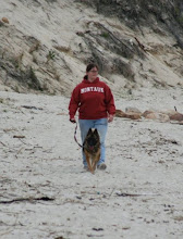
One slight restriction we had was that we are babysitting my Mom's dog, Domino, which meant she was going to experience her first real car trip whether she liked it or not.

It also meant we wouldn't be stopping any place that we would have to go inside where a dog may not be appreciated.


Now since I had a specific time I needed to be in Perryville and since we had Domino the plan was to make most of the trip a driving trip and keep stopping and getting out at a minimum. So originally I planned on just driving past our next point but we couldn't help ourselves and we got out.
The Kentucky Dam is a hydroelectric dam and was built in the 30s and 40s as part of Roosevelt's New Deal to improve infrastructure. First we drove by it on highway 62 and then we turned and drove over it. There is also a walking path for people to walk on it and numerous folks were enjoying the beautiful day and fishing. We were amazed by the difference in water depth between the two sides. Also side note the Kentucky Dam is located in McKracken county Kentucky which maybe the best name for a county ever.

From there we took Highway 62 straight to Paducah. At first we were going to get out and walk along the flood walls that line the Confluence of the Tennessee and Ohio rivers and tell the history of the town. However, and I did not know this until right before the trip, but Paducah is apparently "Quilt City" they have a museum and everything and are very proud of this. Well, I knew we wouldn't go to the museum because we had Domino and also that would be something my Mom would like so I'll save it for a road trip when she is with us. Well as "Quilt City" apparently they were in the midst of a large festival for arts and the festival was right down town at the Flood Walls. So since I didn't have time to justify paying event price for parking we had to skip the Flood Walls. It's ok because we will be back. And it allowed us to spend more time in our next Paducah location: Oak Grove Cemetery.
Buried in Oak Grove Cemetery is John Scopes, the science teacher charged with violating the Butler Act on May 5th, 1925, just three months after the Act was passed. The Butler Act made it illegal for evolution to be taught in TN universities and public schools. The trial was held in Dayton, TN and attracted lots of attention, partly for the history and impact of it and partly for the entertainment of it. William Jennings Bryan and Clarence Darrow acted as members of the Prosecution and Defense teams respectively which helped to bring further attention from the press to this trial. And while Scopes actually lost the trial it did have a lasting effect on American education.


It was a good thing we had some extra time to spend in the cemetery because first we had a really hard time navigating the small cemetery. And once we found Scopes we turned our attention to several other 'notable' graves as well as just enjoying the beauty of some of the different head stones. For example one thing we learned was that Paducah had a strong and talented wood working population as we came across several ornate graves honoring members of various woodworking associations.


My search of well known graves on Oak Grove lead me to the grave of Fate Marable which fit nicely into our trip following the waterways that shaped early American industry because for almost 40 years Fate Marable was a pianist and band director on the steamboats of The Mississippi.

As we drove and walked up and down the lanes of the old section of the cemetery these two graves also stuck out for their beauty and design.


The one on the left is the detailed grave of a child who died at ten. At the base it says "Budded on earth to bloom in heaven." The one on the right had a stone anchor with rope on top of it sitting on rocks in the water.
We had two more graves to find in the old section. The first was for Dollie the Mule, she was a mule who pulled the hose carriage for the Fire Department. When they no longer needed to pull the carriage she moved to Oak Grove to pull carts in the cemetery. However whenever Dollie would hear the sound of the fire alarm she would begin to run up and down the cemetery lanes in excitement. Her faithful service to the city got her an allowance to be buried in Oak Grove. Also buried in Oak Grove is a second mule named Tom, however I never found out what earned him the allowance.


Finally we went to the new section of the cemetery to see one last grave. It is a sad and kind of heartwarming story. Apparently in 1991 a young man's body fell from a plane where he was hitching a ride either at the wheels or another compartment. Not knowing anything about him a tombstone was erected for John Doe and the people of Paducah 'adopted' the unknown young man. Somebody would bring flowers to his grave and the search continued to find his identity. It took eight years but he was eventually identified and his family was contacted. A new grave stone was made with his name and birthdate. His grave was left in Oak Grove where the city and people who adopted him have continued to care for his grave. As you see in the picture there was a fresh bouquet at the grave when we stopped by.

Before we left Paducah we had one more stop to make at a wood carved statues called the Wacinton Statue. A sign near the statue explained that it had been carved from a 56,000 pound Red Oak in honor of the Chickasaw Indians who lived in the area.


After that we left Paducah but we will have to go back to see the Flood Walls, Quilt Museum and the railroad museum.
Then we cut across Kentucky, rather then follow the bending Ohio River, to the Kentucky/Missouri/Illinois state lines and the Confluence of the Mississippi and Ohio rivers. We crossed over both rivers and stopped at Fort Defiance for a little walk about.

I love this picture that Meghan took of a fallen branch at the confluence. To the left is the Mississippi and the right is the Ohio river and you can see the difference in the water of the two rivers.

Along the way we also found several historical markers and information placards about Lewis and Clark as they travelled and helped form the United States.
Next we continued our northern turn towards what was listed as a historic tunnel in Cairo, Illinois, which was used to help move the railway cars that traversed the country. As we drove through Cairo, with the Ohio river to or right we could see paintings down the street on flood walls. We turned down one of the roads to get a better look at the murals.


My phone is being difficult so the pictures are blurry, I think because I emailed them to myself instead of transferring them directly to my computer.
The area in front of the walls are uncared for and over grown with weeds. Cairo, I'm sure was at one time a bustling and busy place especially with its spot along the river and the multiple train lines that would have run through. Now however it is mostly boarded up buildings along the main road we took.
Then we went further north to the Illinois/Missouri border again to cross over the Mississippi and land at Cape Rock Park in Cape Girardeau Missouri. Now a Cape, geographically, is a piece of land extending into a body of water generally the ocean. In this case however we have an inland cape sticking out into the Mighty Mississippi river. The cape got it's name for a Frenchman Jean Baptiste Girardeau who established a trading post sometime around 1733. The Cape has since lost its shape because of tilling that was done to make way for the Missouri Pacific Railway lines and Frisco line that ran from Cairo to St. Louis.


And with that we were less then an hour away from Perryville and strangely enough ahead of schedule. As a result we were able to stop at a St. Mary of the Barrens National Shrine. Unfortunately we didn't stop long because the church was under construction and everything was closed up. Though the woman at the gift shop did tell me I could probably get inside and look around before one of the priests would call me out.

We left and went over to the community center where Dr. Russo would be speaking. After a full day of road tripping we had finally reached the main reason for the trip. Meghan and I had both gained so much knowledge and preparation advice from Dr. Russo. I was excited to meet her and hear her speak and have a chance to speak with her about my personal experience. As we had been driving I had been trying to think of how best to put into words the experience. Obviously I have already put two past blog post here about it trying to capture every detail. My opinion today months later is still basically the same. I cannot put into words everything about that day because words cannot describe it. I mean it truly was an existential experience. Like open to the true nature of the Other and it's existence whether that be nature, wander, awe, and the others around us. There was dialogue between nature and myself and a connection in those moments that have lasted even through to today. Last year was a tough year for me but for that day everything was ok. Still the best way I have found to describe it is that I never truly understood what "awe inspiring" meant until that day. It was nice to sit there with Dr. Russo and several others like me who had recently experienced the eclipse and think back on it and how it was and how it changed us and affected us.
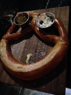
After the meeting it was time to get something to eat before heading home for the ride. We stopped at two places owned by one couple who are, by the way, two of the coolest people I have ever met. They own The Jackson Street BrewCo and at the other side of the block Mary Jane Burgers. We couldn't go to the Jackson Street BrewCo because we had Domino. Mary Jane's Burgers had outdoor seating. They allowed us to sit at the outdoor seating with the dog and I just walked over to the BrewCo to get our flights and food.


Zaza was our order holder and there were a variety of other famous entertainers to choose from. We got a pretzel appetizer and artisan pizza for a main course. Everything was delicious. I think we tried almost every beer and brought home a growler to enjoy later.
And then we were basically retracing our drive as we went home. We did sleep for a few hours overnight because the day had started early and while it was only 8 hours of driving it was a lot longer in actuality.

Slight note: I'm not sure which road we took through Land between the lakes so it is not reflected here.
Also an interesting note: in this trip we crossed the Mississippi four times from Illinois to Missouri, back to Illinois, and then back to Missouri, and then back to Illinois. In the last trip we crossed the Mississippi twice from Tennessee to Arkansas and then from Missouri to Kentucky. Next trip may have us crossing the Mississippi again only further south by Baton Rouge Louisiana. We'll see.
Anyway I'm thinking about buying a map of the US with as many highways as possible and I'll start drawing the road trips on to it. Eventually I'll have it pretty covered I hope.
No comments:
Post a Comment